June 12th 2027
50K, 25K
Blodgett, Oregon

June 12th, 2027
Run to the highest point in the Oregon Coast Range!
01
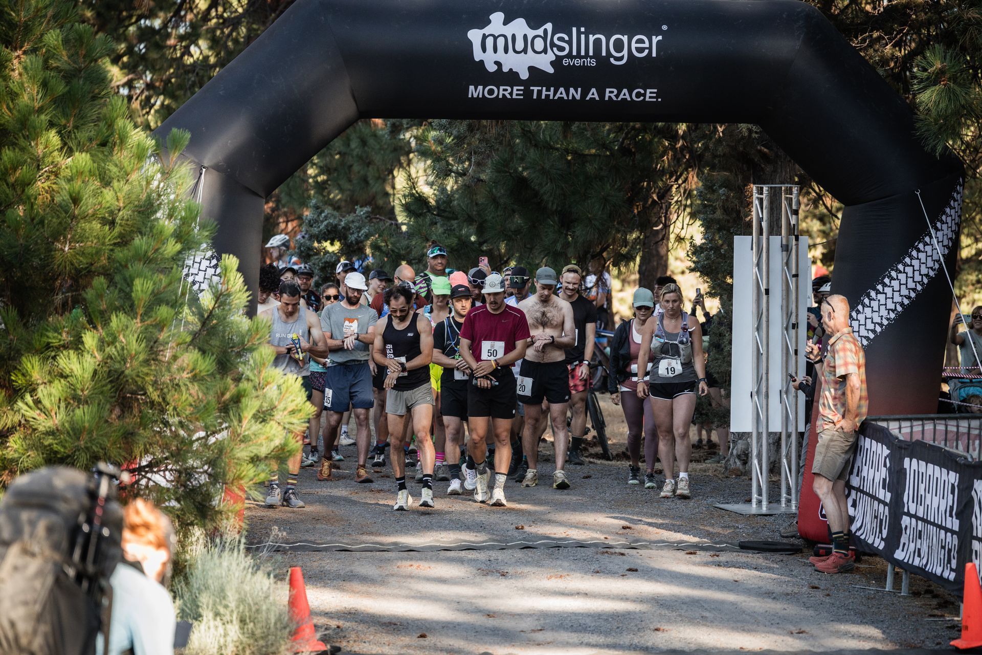
Saturday June 12th, 2027
50K early Start 6:30am
50k: 7:30 am
25k: 9:30am
NO DOGS ALLOWED WITH OUR CURRENT INSURANCE CARRIER. SORRY
9HR TIME LIMIT FOR THE 50K plus early start option for 10hrs
Details below or click the race guide below
02
EARLY PRICING
Early Pricing Starting 9/1/2025 through 1/2/26
Deluxe Tri-Blend Shirt guaranteed through May 1st when we place the order!
100K $185.00
50K $125.00
25K $85.00
Price Increases
1/2/26 and 5/1/26
MAX CAPACITY
300 RUNNERS
Register the day of the event at the Blodgett School if space exists
03
PACKET PICKUP
Friday
Blodgett School outside with camping checkin for tents only
4- 7 pm
Saturday
4 am until 30 minutes before your start in at the Blodgett School Gym
Please drop off all drop bags for aid stations on Friday night and or
Saturday before your start
Coffee available in am and hot water
Please park at the Church Friday!
If this changes do to an activity we will let you know!
04
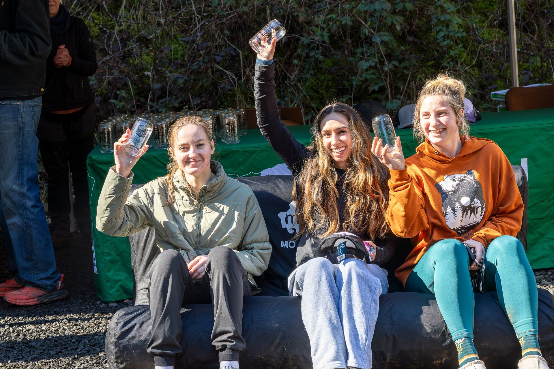
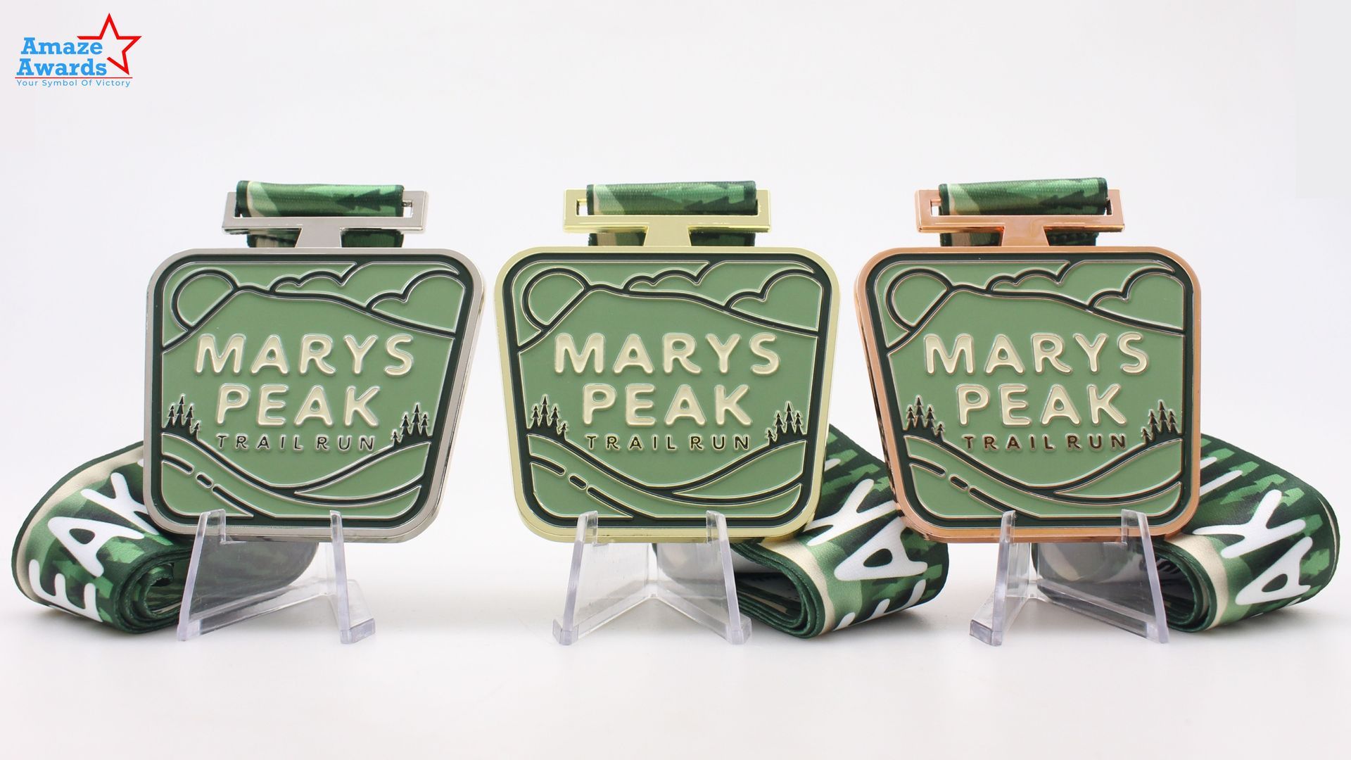
AWARDS and Whats Included
Custom Awards 3 deep while you enjoy your post-event burrito
1:pm 25K
2:45 50K
Custom awards will be presented to the top 3 finishers in each category:
Podium awards include custom medals for the top 3 in each age group in 2027. Plus, overall awards for the top person overall per distance
Free entry to the following year for the top 3 in each distance
- Equal Podium and Awards
- Womens Specific Apparel and Swag
- Menstrual Products at Aid Stations
- Women on the Start line
- Pregnancy and postpartum policy
Stunning and Epic on June 13th, 2026
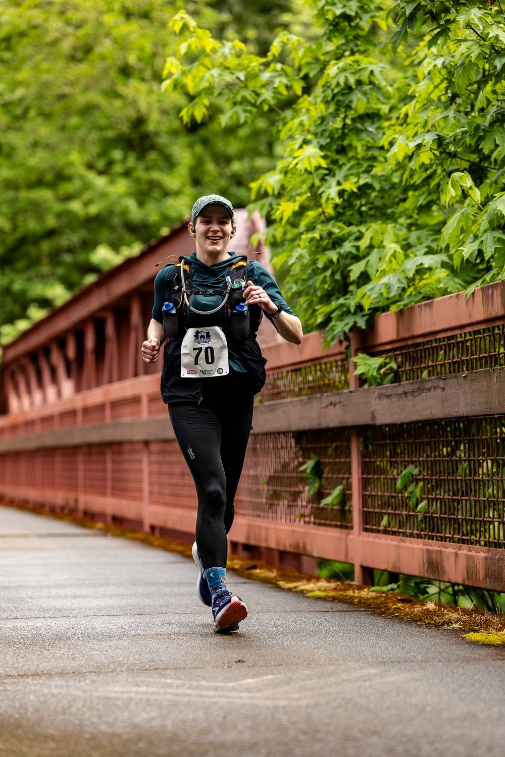
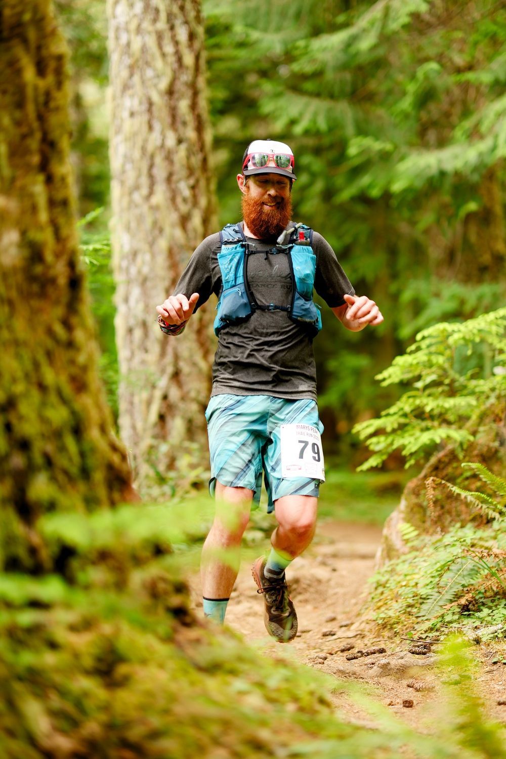
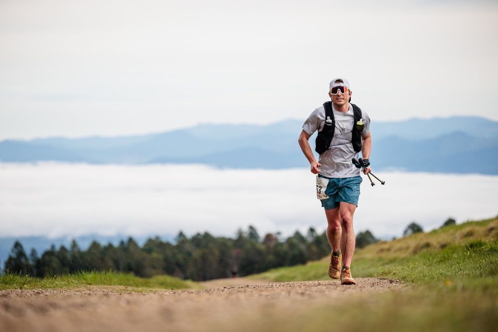
Run with us for 50K or 25K in one of the most beautiful places on the planet.
Nestled in the Heart of the Willamette Valley sits the highest peak in the Oregon Coast Range Marys Peak at 4101 Ft. Marys Peak was known as Chateemanwi, or “place of spiritual power” to the native Kalapuya tribe who used the land for spirit quests.
Nestled on her slopes are a town, a cemetery, and an old logging railroad. The streams that flow down the mountain’s sides provide water to Corvallis from the Rock Creek Watershed. Many of the lands surrounding Marys Peak were privately owned, until they were added to the Siuslaw National Forest to protect the source that provides Corvallis with 40% of their drinking water. In addition the Forest Service, part of the land in the area is managed by the Bureau of Land Management.
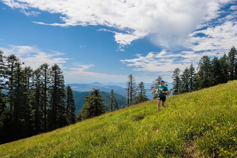
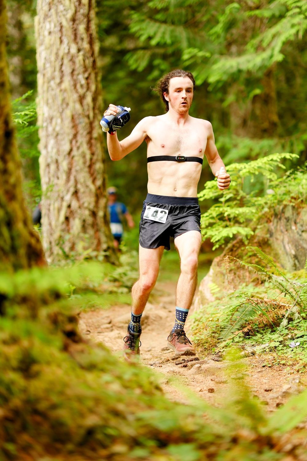
This trail run is challenging for all, with the rugged terrain and dense forest of ferns and wildflowers! Marys Peak is second to none when it comes to the word "Epic," "Stunning," and "Special" From the diversity of plant life to the size and stature of the Douglas Fir trees, you will be amazed!


Thank you to these great sponsors

Get involved!
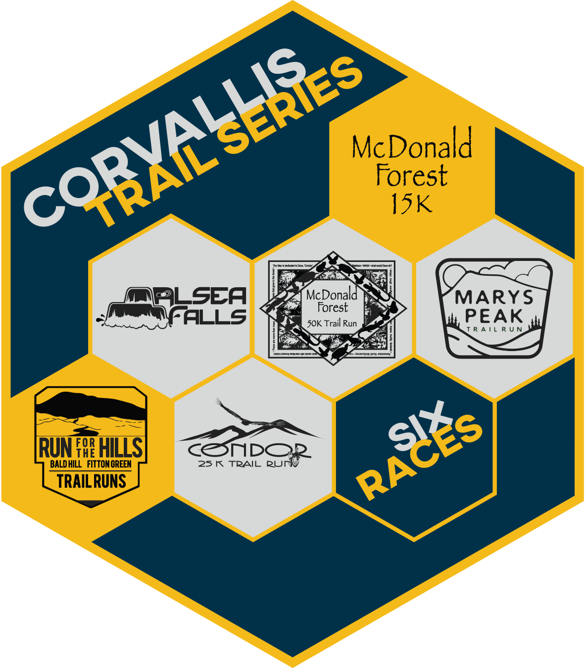
Marys Peak Trail Run is proud to be a part of the new Corvallis Trail Series.
The Corvallis Trail Series aims to increase interest in trail running and support local trail races in a comprehensive series of events. The Series highlights the extensive trail network around Corvallis providing opportunities for runners of all abilities. Please encourage your family, friends, or co-workers to jump in and give trail running a try!
Course Details 2027 and 13th anniversary Marys Peak 50K/25K
START TIMES
Marys Peak Trail Runs
June 12, 2027
50K: 7:30 am,
Optional early start 6:30 am for runners looking to make the cut-offs
25K: 9:30 am
Race Guide below with the details
Course
Run with us for 50K, or 25K in one of the most beautiful places on the planet.
Nestled in the Heart of the Willamette Valley sits the highest peak in the Oregon Coast Range, Mary's Peak at 4101 Ft Marys Peak was known as Chateemanwi, or “place of spiritual power,” to the native Kalapuya tribe, who used the land for spirit quests.
Nestled on her slopes are a town, a cemetery, and an old logging railroad. The streams that flow down the mountain’s sides provide water to Corvallis from the Rock Creek Watershed. Many of the lands surrounding Marys Peak were privately owned until they were added to the Siuslaw National Forest to protect the source that provides Corvallis with 40% of its drinking water. In addition to the Forest Service, part of the land in the area is managed by the Bureau of Land Management.
This trail run is challenging for all, with the rugged terrain and dense forest of ferns and wildflowers! Marys Peak is second to none when it comes to the words "Epic," "Stunning," and "Special." From the diversity of plant life to the size and stature of the Douglas Fir trees, you will be amazed!
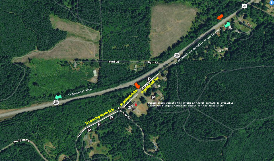
Parking Do not park where no Parking signs are placed
Saturday's Schedule
START TIMES Wave Starts
Blodgett School Start
20 Minutes West of Corvallis
50k: 7:30 am Optional early start 6:30 am
25k: 9:30 am
Pacers can pace from Aid Bravo 2.8 miles from the Blodgett School! Please walk 2 miles to this area or have someone drop you off. Up Tum Tum Rd from School to Albertson Gate
Support crew maps below
Dogs are not allowed to run! The insurance excludes them from coverage. Sorry! I love dogs!
WHATS INCLUDED
Well marked course
2 aid stations 25K
4 aid stations 50K (six opportunities for support with Charlie and Bravo passing twice
- CUSTOM T
- Post race Burittos
- Photos available for purchase
- Live Music
ADVICE
Make sure you are physically fit enough to run your distance. The 25K has plenty of time for a great day in the woods as well as the 50K Walking is encouraged when the hills are too much!
The 100K is the event to bucket list and or if you are training for a later season 100 miler or 200 miler this is your event!
CAMPING
Included at Blodgett Church if available
No Alcohol on school premises.
Camping can begin anytime after 4::30pm
Aid Stations
Hammer Nutrition HEED at all stops!
Carry calories and water.
Water at aid station is 16 Oz single serve water bottles for you to use.
We will have Hammer HEED at all Aid Stations
After using your drop bag for the final time, please move it from the right side of the road to the left to be returned to the school
DROP BAGS
Label with your first and lase name and bib number
Please drop the night before in the Blodgett School Gym or in the am to place for Bravo or Charlie aid stations. When finished on course place on a tarp for our crew to bring back to the base
AWARDS
Custom Awards top 3 in all age groups
1pm 25K
2:30 50K
50K and 25K finisher awards as well
U20 (19 or under), 20-29, 30-39, 40-49, 50-59, 60-69, 70+
CUT OFF's Updated
50K cut off's 9HR Pace. Please know 50K you have more time with 100K's out and about in the woods. 25K please ignore these, you have until 6:30 to finish
- Aid Alpha 4.9 M 9am
- Aid Bravo 18 M Summit 12:30 pm
- Aid Charlie 24.7 M 2:30pm AM 100K, 50K 2:15 PM
- 50K please remember this is Simply a pace to go by, and you have more time than above to finish with the 100K being out much longer.
- Aid Delta 8:30pm even though at this point we will get you to the finish or do what we can to make that happen.
Poles, Pacers and More
Poles are fine! Use caution when on Marys Peak with other users and runners coming you way.
No Dogs allowed to run due to the insurance exclusion for all events.
Support Crews See Maps below to support your 50K runner at Aid Alpha or Aid Bravo or Charlie. We will have Water and Hammer Heed only at the top of the Peak. This aid will be called "The Peak"
Aid Delta
Aid Bravo
2 miles up Tum Tum you can walk in the Albertson Tree farm Gate to support your friend or be dropped off. Drive slow with runners finishing.
Gate is on left side of the road and 3/4 of the mile to the aid station after walking through. Do not drive
Pacers can start from Bravo only off of Tum Tum Rd
Please have all runners sign the waiver and please list the person you are supporting at the top of the waiver.
Things to Do in Corvallis
https://www.visitcorvallis.com/things-to-do
After the event, the Pacific Ocean is only 30 minutes away! A great place to watch the Sunset!
Make your way to the Summit!
Only a few times per year you may find space for a special day! See below for maps of how to drive to main areas of support for the Marys Peak Trail Run!
Directions to support Stations. Course Map below
2027 Map
FAQs
Please contact us if you have a question anytime
Trail Markings
Pink arrows will guide you! Orange and Red Striped Ribbons will also be placed with multiple ribbons on the side of the turns. Also, we have placed Yellow X NO Signs on warning you of. The wrong direction in some instances.
Trail Sisters Approved
We support women and the policies that Trail Sisters has designed for your next run! Check out the event policies page for more information.LINK
Credit Policy
Can I downgrade during the event?
Distance Change Policy 100K only
YES! You may change your distance during the event: Yes you may switch your distance prior to the event. Please note upgrading will cost x amount, no refunds for downgrading. Please note that upgrading will cost x amount, and there are no refunds for downgrading.
100K runners: If you decide to switch to the 50K, notify staff when you return to Blodgett School after completing your first loop.
Once you notify us, we will rescore you for your new distance.
Important: Athletes who change distances during the race are not eligible for podium awards, since the full course was not completed in the original registered distance.
UPCOMING EVENTS 2026